A surreal, dreamlike energy abounds in Lake Titicaca. It is evident that the early inhabitants were positive, happy and spiritual people. When living these feelings, it is easy to make a distinction between the positive and the negative. Although, human sacrifices were common, and an offering to their god meant death, good vibrations are all that remain. Once home to the Inca Empire, and still home to many descendants, Lake Titicaca is a powerful and empowering setting that allowed the natives to live a peaceful and separate life away from the mainland empire. Stretching more than 75 kilometers across and over 200 kilometers in length, the lake truly seems oceanic. Lake Titicaca is the world’s highest navigable lake. There are many myths and stories about the lake, and it is certain that there is still much to be discovered.
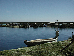
Reed boats, decorated with beautiful art work, stand out on the island of Uros, which is the first stop once leaving the dock at Puno.

The view as one leaves Puno, Peru.
The Uros islands consist of 50 floating reed- woven masses. The islands were added to, during the Incan period, and some evidence suggests that the early people might have inhabited these floating fortresses. Of the 50 islands that exist, only 15 are open to tourism. The reed boats were the main form of transportation throughout the lake and held a capacity of up to 25 people.
-
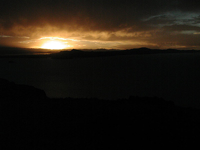
- Sunset on the island of Amantani, ruins of Pachatata in the foreground.
The second stop to the northerly islands took two and a half hours by boat, and provided quite a welcoming sunset. The island currently has eight communities and holds 5,000 native inhabitants. We were lucky to stay with one of the natives and share in a very special evening full of dancing, and listening to many legends about the island. It was here that we learned the significance of the Incan cross. As always, the culture still leaves us in awe.

The happy natives with their welcoming smile and pleasant demeanor make Amantani island memorable.
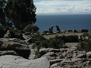
The third island on our northerly visit of Lake Titicaca is full of ruins and cultural traditions.
One story that everyone loves to share is of the great under water explorer, Jacques Cousteau. In 1975, he developed a research project in Lake Titicaca in order to discover the hidden rooms of gold and silver. The rooms, as the legend goes, were buried somewhere in the lake. When the Spanish began their conquest of the Inca Empire, they ordered the Incas of Lake Titicaca to give them one room filled with gold and two other rooms filled with silver. If the Incas followed their request, their lives would be spared. To this date, the rooms have not been discovered; although, many feel it is a well-kept secret by the inhabitants.
For Cousteau’s expedition, he ordered several underwater devices and a submarine to carry out this task. His searching led to nothing. No rooms of gold or silver were found, but he did welcome another discovery of the Lake. Cousteau discovered the Underwater Toad. Never before found any where on earth, the toad was a unique find. It stretches nearly 60 inches in length. The toad is an underwater giant!

At the Copa, Copacabana. Copocabana, Bolivia, is the nearest town to the border of Peru. Copocabana, Bolivia is not to be confused with Copocabana, Brazil. It is still good reason to celebrate, though.

The ride out to the southern islands on Lake Titicaca has amazing geological uplifts in the water.
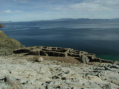
The most impressive ruins on the northern portion of Isle de Sol.
From the southern part of the island, this is about a four hour, one way hike, at 11,000 feet. There exists two simple pathways to follow and once arriving at either side of the island it is quite obvious which pathway goes where. For this, one doesn’t need a map, but it will feel more comfortable asking around. For a day hiking trip, Isle De Sol is perfect. Great views, hot sun, two unique beach fronts, several ruins, and ample opportunity to see a great sunset await the visitor. We highly recommend making it a day for hiking.
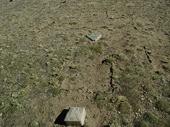
The Original Inca Cross, on Isle De Sol...said to be a represenation of many things, including a map...
It was amongst many things a map for the native Incas. When all the lines are connected on the outside borders of the Inca Cross, it forms a octagon. Drawing a line through the center, and connecting the points, one finds that it can be used as a measuring device between geographic locations. In this case, the cities of Pubulcara, Cusco, the Island of Amantani (Pachatata), Tiwanika and Potosi are all in direct alignment and are all equidistant. Pachatata being the center point of the Inca Cross. This point gave us very strong feelings and as one said, “I felt like I was dreaming”, while he visited this area.

The impressive mountain range of the Cordillea Real in Bolivia.
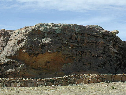
The Rock of the Puma sits overlooking the Inca Cross and a table that was used for human sacrifices.
The Puma was the keeper of this area. Looking strait at it, one can see the upper indentations of the eye, the lower left ear that stands out, the gaping mouth with the two nostrils above it, and the tail on the far right. We noticed while staring at the rock that the Puma became more evident as different light hit it.

The sun sets on the lake and our view from Isle de Sol is slowly darkened.
Leaving Lake Titicaca you carry the strength of it with you. Although, it isn’t a entirely physically demanding journey, it feels like an inner rest and rejuvenation.
*Feature written and photographed by Phillips, July 2001. Information regarding Lake Titicaca, exploration and discoveries of island dwellings and other historical information was supplied by Alina Guides.
GUIDE NOTES AND DIRECTIONS:
Lake Titicaca is unique because to see all of it, it must be explored from both sides and ultimately two different countries. Arrangements can be made easiest from Puno and Copacabana. ALINA TOURS,
LIMA 343. Located in the heart of Puno
TELEFAX: 054-357139, 054-364723, CELL: 921038
EMAIL:
alinatours@punonet.com
alinatours@terra.com.pe
